Create a 12-sided, 3D globe to display research information about life on one of earth's continents.
1.
Research the continent of your choice to learn about its land forms, resources, climate, industry, agriculture, history, and wildlife. Collect facts and pictures about life on the continent.
2.
To make a globe that displays what you are learning, use a compass and Crayola® Colored Pencils to draw 12 circles with a diameter of approximately 5 1/2 inches (14 cm). Within each circle, draw a pentagon, with each line measuring about 3 inches (7.6 cm). Each point of the pentagon must touch the sides of the circle. Cut out the circles with Crayola Scissors.
3.
Using colored pencils and/or Crayola Crayons, color the background of each pentagon in soft, light colors. Write important information about the continent on each of the 12 pentagons. Include illustrations of items such as maps, birds, insects, animals, housing, and crops.
4.
To assemble your globe, fold all five lines on each of the 12 pentagons upward. Place one circle face down, resting on its edges. Attach one edge from each of five more circles to it with a Crayola Washable Glue Stick. Continue to join the edges until you have six circles connected, forming one-half of a ball. Make another half-ball in the same way with the remaining six circles. Attach the edges of the top half to the lower part of the globe.
Explore and respond to the work of Marcel Duchamp, creating a collage of a reworked face.
How can your class become a community of learners? These self-portrait paper dolls encourage everyone to become better f
Library windows are just the place to share reviews of favorite books. Use Crayola® Washable Window Markers or Crayola W
Stick up for sharp-toothed creatures who get a bad rap! They are just trying to survive like all other animals.
What’s at the center of a galaxy? A black hole! Look WAY beyond a black hole by creating a vivid galaxy and observation
Feet come in all different sizes. Find out just how wide the range can be in your age range while exercising your graphi
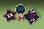
St. George’s Day (or any day) is the perfect time to celebrate brave deeds. Create colorful bravery badges for yourself
Who is your hero or heroine? Create a unique, handmade book that tells the story of bravery, such as Kate Shelley’s rema