Design an interactive map with modes of transportation that actually move across the ocean.
1.
Research maps of North America and Europe. Locate New York City and Paris, France. Find out about various current modes of transportation between the two cities, including times, flight or cruise paths, distances, vehicle weights, and speeds. Locate similar information about Charles Lindbergh's first transatlantic flight.
2.
On poster board, use Crayola® Colored Pencils to draw a map (to scale) showing the two continents and the Atlantic Ocean from New York City to Paris.
3.
Cut small pieces of poster board with Crayola Scissors to make sign posts for the two cities. Attach to the map with a Crayola Washable Glue Stick.
4.
Make a three-dimensional boat and plane to string from New York to Paris. Cut out the body of an air plane from poster board. Draw the airplane body on each side, then glue on wings cut from poster board. Add a small tab under one wing by gluing two sides of a small piece of poster board to the wing, leaving the middle of the tab pulled away from the wing a bit. Dry. Thread string or yarn through the tab, anchoring the ends to New York and Paris.
5.
To make the boat, fold a small piece of poster board in half and draw each side of a boat. Place string inside the fold, then glue the bottom inside edges together. Be sure to keep string from sticking to glue. Anchor the ends of the string to both cities
6.
Create fact cards by folding index cards or poster board cut to size. Use Crayola Markers to write topics on the outside of cards and information inside. Glue cards to empty spaces on the map.
Build bridges and friendships! Plan and construct a bridge with this constructive lesson that’s inspired by a Maya Angel
What’s your strategy to win at Mancala? Give this ancient Ghanaian game a contemporary twist! Make your own set with Cra
Have fun with your friends and family when you ask for the juice naranja or point out your sneakers blanc. Design and pl
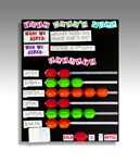
Student pollsters gather, summarize, display, and analyze their opinion poll results. What more could you ask?
Investigate the Aztec calendar then create a fictional scroll calendar with details of an imaginary trip to Mexico.
Create a time line with colorized copies of photos of Dr. Martin Luther King, Jr.
Think like an advertiser and come up with new names to replace familiar ones.
Showcase children’s family heritages and traditions with bright colors and distinctive patterns. These individual, no-se